


j9

AMOURETTE
User
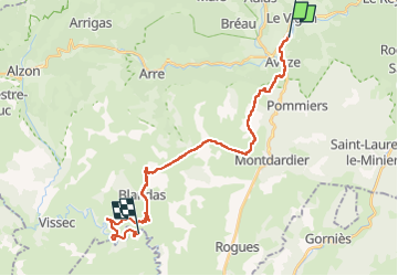

Length
26 km

Max alt
674 m

Uphill gradient
707 m
Km-Effort
35 km

Min alt
225 m

Downhill gradient
601 m
Boucle
No
Creation date :
2022-09-13 06:00:50.166
Updated on :
2022-09-13 14:04:09.543
5h26
Difficulty : Very difficult

FREE GPS app for hiking
 SityTrail
IGN / Geographical institutes
SityTrail Plus
The world is yours!
About
Trail Walking of 26 km to be discovered at Occitania, Gard, Le Vigan. This trail is proposed by AMOURETTE.
Positioning
Country:
France
Region :
Occitania
Department/Province :
Gard
Municipality :
Le Vigan
Location:
Unknown
Start:(Dec)
Start:(UTM)
548461 ; 4870148 (31T) N.
Comments